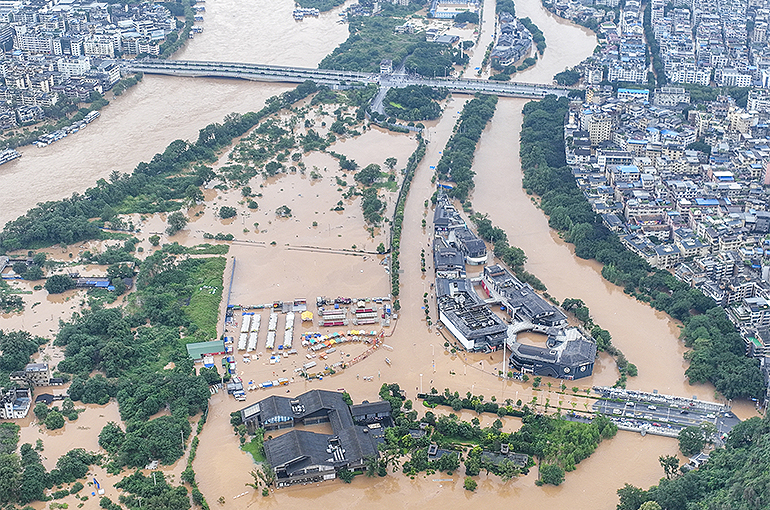
 Southern Chinese City of Guilin Sees Worst Flooding Since 1998
(Yicai) June 20 -- Guilin, a city famous for its beautiful scenery in China's southern Guangxi Zhuang Autonomous Region, has suffered its biggest flood since 1998, with the water level exceeding that year's highest by 10 centermers and the warning limit by 2.55 meters.
The floods in Guilin were due to continuous heavy rainfall and flood discharge from the upper reaches of the Li River, China Central Television News reported yesterday.
The average precipitation in Guangxi reached 152 millimeters from 8 p.m. on June 12 to 3 p.m. yesterday, with heavy rainfall mainly seen in Guilin, Hezhou, and Liuzhou, reaching an average of 323.7, 249.8, and 210.4 millimeters, respectively, according to the local meteorologic authority. Some towns and villages had rains of over 700 mm, peaking at 945.5 mm.
The flood has severely impacted traffic in Guilin's urban regions and tourist spots, with multiple bus routes halting services and schools temporarily closing. The renowned Li River scenic area in Yangshuo county canceled cruises, while the Guilin Railway Station has temporarily suspended services because of ponding, with trains available at the Guilin North Railway Station.
Floods have hit eleven cities and 64 counties in Guangxi since June 13, while 431,000 people have been affected as of 4 p.m. yesterday, according to CCTV. Local authorities have relocated and resettled 66,000 residents.
Guangxi's meteorologic authority forecasted that there will likely be moderate to heavy rainfall in Guilin, Liuzhou, Hechi, Hezhou, Fangchenggang, and other cities starting late yesterday to early today, with some to face rainstorms. The local center of hydrology predicted that there will be floods in the upcoming 24 hours along the Gui River, with water levels to reach two to three meters above the warning limit.
Editor: Martin Kadiev